7-Second Gain: Royal Navy Nyan Drone Deployment Increases Vessel Vulnerability in UK
TL;DR
- 93-Mile Range: Royal Navy Nyan Drone Deployment Risks Strategic Visibility. Does a 7-second reaction gain justify removing human-in-the-loop control in naval drone strikes?
- $300K in Fines: Drone Surveillance in Sacramento Sparks Privacy-Revenue Conflict. Does the use of drone facial recognition for municipal fines constitute public safety or an illegal revenue stream?
🤖 The Nyan Deployment: Questioning the Naval Strike Radius
7 seconds. A negligible gain in reaction speed for the systemic risk of removing human control 🤖. This is equivalent to trading a pilot's intuition for a rigid script. Increased electronic footprints expose launching ships to SIGINT. Royal Navy—is efficiency worth total vulnerability?
On July 3, 2026, the Royal Navy launched the Nyan drone from the USS Peter Blackett during Exercise Neptune Reach. Developed by BAE Systems' Callen-Lenz division under Project VANTAGE, the Nyan is a One-Way Effector (OWE) utilizing quantum navigation and micropropulsion. While marketed as a zero-visibility strike tool capable of bypassing GPS vulnerabilities, the system's reliance on pre-programmed flight paths to designated targets suggests a rigid operational profile rather than true autonomous intelligence.
Does Autonomy Equal Strategic Advantage?
The shift toward a hybrid navy aims to decouple strike capabilities from human reaction times, but the actual gains remain marginal. The integration of Qineti-Q guidance reportedly reduces operator reaction delay by 7 seconds—a negligible window when contrasted with the systemic risks of removing human-in-the-loop control. Furthermore, the "stealth" nature of the Nyan is contradicted by its electronic footprint; increased emissions during deployment expand the detectable signature of the launching platform. This vulnerability aligns with recent intelligence regarding Iranian SIGINT penetration, which triggers automated counterstrike protocols and degrades operator efficiency.
Operational Metrics:
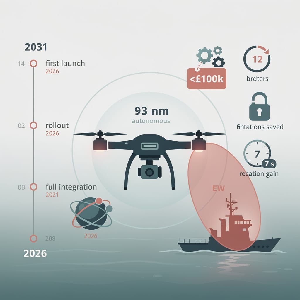
- Range: 93 nautical miles autonomous reach.
- Cost: Unit production remains sub-£100,000, mirroring a broader shift toward mass-produced, expendable drones as seen in the US move toward "Massed Modular Aircraft" to replace costly $30M+ Reaper platforms.
- Personnel: Eliminates the need for pilot rotations, saving an estimated 12 rotations annually.
Deployment Timeline
- July 2026: First successful at-sea launch and target acquisition during Neptune Reach.
- 2026–2029: Incremental rollout and field validation of modular unmanned effectors.
- 2031: Projected full integration as part of the broader five-year scaling goal for drone fleets.
Technical Trade-offs
Efficiency: Low unit cost → enables saturation strikes but risks high-volume attrition. Risk: Active autonomous systems → elevates vessel visibility to enemy electronic warfare (EW) and AESA radar detection. Control: Quantum navigation → eliminates GPS jamming dependency but removes real-time tactical intervention. Speed: 7-second reaction gain → accelerates conflict escalation without proportional strategic insight.
🚨 Precision Policing or Aerial Surveillance?
$300,000 in fines—alarming efficiency. That's thousands per violation via drone surveillance 🚨. Automated facial recognition is turning city skies into revenue streams. Safety or state-sponsored profit? Sacramento residents: is your privacy worth their 'efficiency'?
The deployment of certified drone surveillance by the Sacramento Fire Department during July 4th celebrations demonstrates a shift toward automated enforcement. By utilizing GPS and facial recognition to capture precise locations, the department issued approximately 70 fireworks violations, resulting in $300,000 in total fines. This strategy enables immediate citations and prosecutions that were previously impossible without human witnesses.
Does Efficiency Justify Intrusion?
Operational data indicates a shift toward aggressive financial penalties tied to device counts. Federal enforcement patterns mirror this trend; during the FIFA World Cup 2026, the FBI seized 115 drones across SoFi Stadium, Dallas, and Philadelphia, where unauthorized flights within Temporary Flight Restrictions (TFRs) incur fines up to $100,000. While officials frame these measures as safety-driven, the use of drones to convert visual anomalies into arrest-eligible data streams indicates a streamlined mechanism for revenue generation through high-tier penalties.
State-mandated bans, enforced by CalFire's zero-tolerance wildfire alerts, have intensified the crackdown. These systems utilize thermal imaging sensors to trace ignition sources in real-time. However, the integration of continuous aerial monitoring and facial recognition creates a framework where municipal safety intersects with significant residential privacy infringement, triggering daily legal motions challenging unpermitted recordings.
Surveillance Impact
- Privacy: Continuous aerial patrols → escalation of civil liberty concerns and legal challenges over facial recognition.
- Financial: Fines reaching $100,000 per incident → disproportionate economic burden based on TFR and per-device charges.
- Safety: Reduced direct fire risks → offset by urban violence gaps, such as the July 10th murder of 9-year-old Jade Riser in Milwaukee, which occurred despite rising drone adoption in policing.
The Enforcement Trajectory
The reliance on "Drone as First Responder" (DFR) systems suggests a permanent expansion of surveillance. This is evidenced by the Orlando Police Department's activation of a full-scale DFR network using eleven Skydio drones to meet sub-three-minute response targets.
- July 2026: Large-scale drone enforcement in Sacramento and San Diego; 70+ violations recorded in key sectors.
- Q3–Q4 2026: Projected expansion of adaptive drone deployment for broader municipal ordinances.
- Early 2027: Forecasted state mandate for a remote-capture facial recognition network within six months.
The current model demonstrates that when robotics hardware meets strict regulatory frameworks, the result is a system that prioritizes technical compliance over community consent. The transition from reactive fire prevention to proactive aerial surveillance indicates a preference for algorithmic governance over traditional public safety engagement.



Comments ()